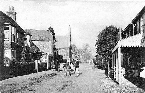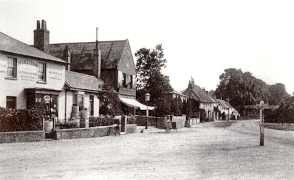
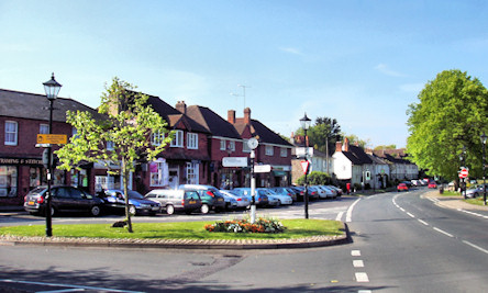
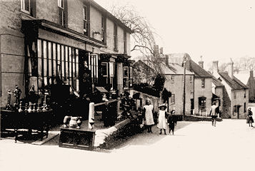
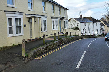
1. The Square. The shops in The Square have
changed substantially since the photo on the left was taken
in the early
20thC. All the shops in the picture have been demolished and re-built with the
exception of the one on
on the near left (Pesketts) which is now occupied
by Butts Estate Agents and The Stone Room. The tall shop was
Dench's (later
Marsh's) grocery stores. No car parking problems in those days. The road
direction sign has been repositioned.
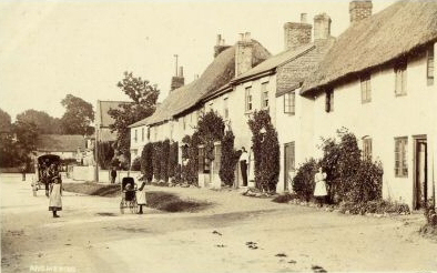
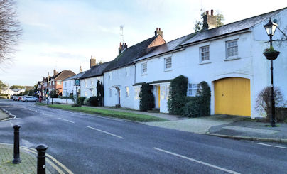
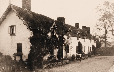
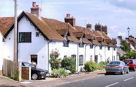
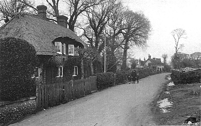
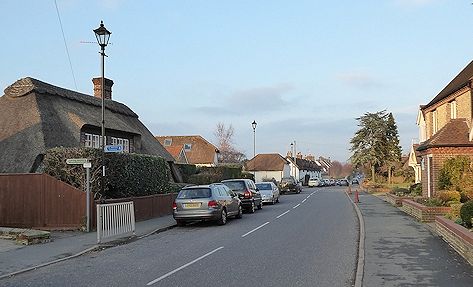
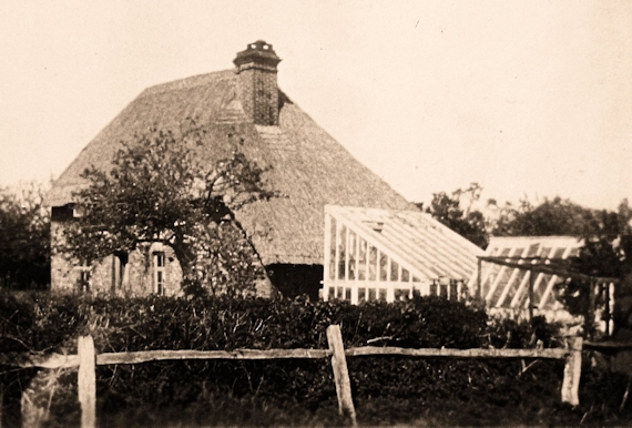
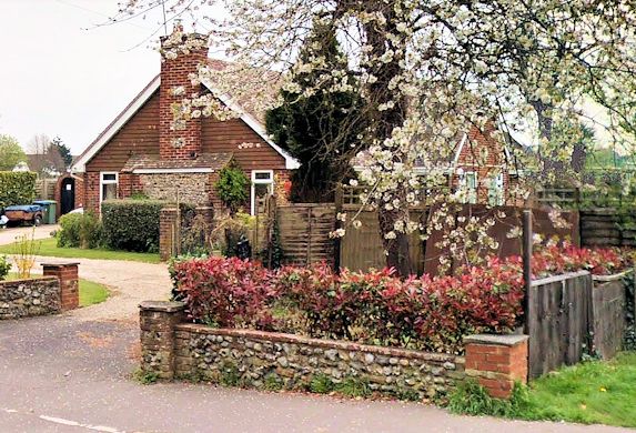
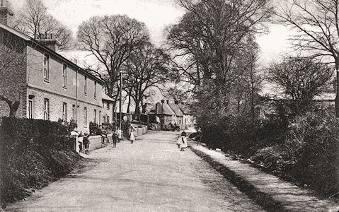
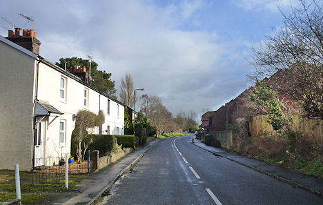
2. Elm Grove. The photo on the
left was taken over 100 years ago. Since that time, the thatched cottage on the
right
has been demolished. It can be seen that Elm Grove Cottage was thatched at that time. Dolphin Cottage (yellow doors) was once a sweet shop
with the square bay shop windows. The owner has deliberately retained the old shrubs in positions close to where they were a century ago as there
have been structural changes over the years. Note that the grass bank in front on the cottages is still there.
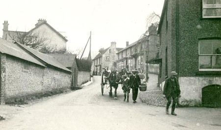
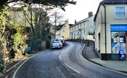
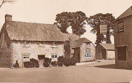
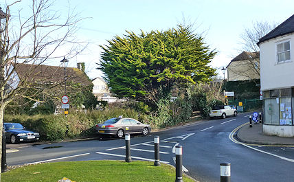
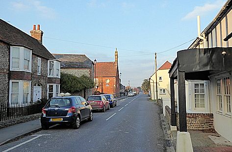
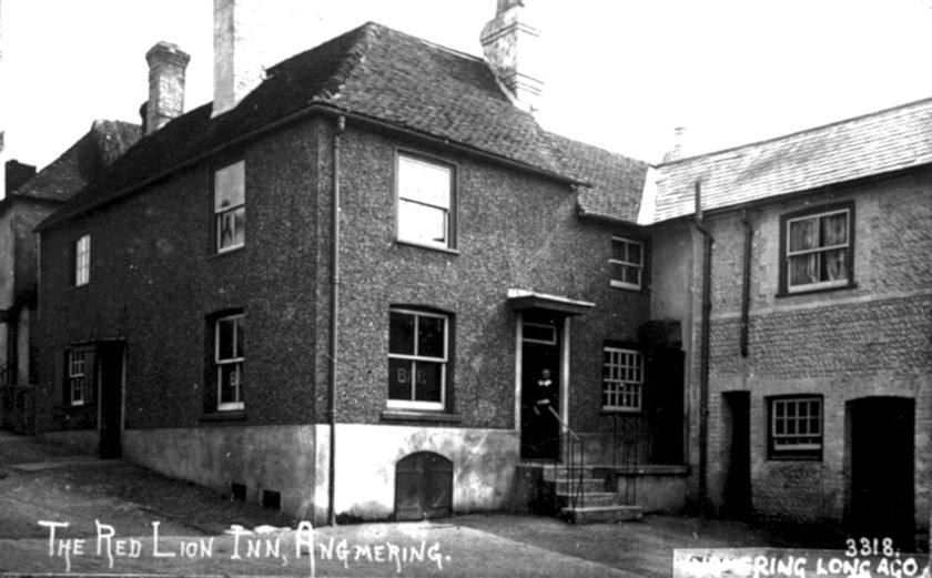
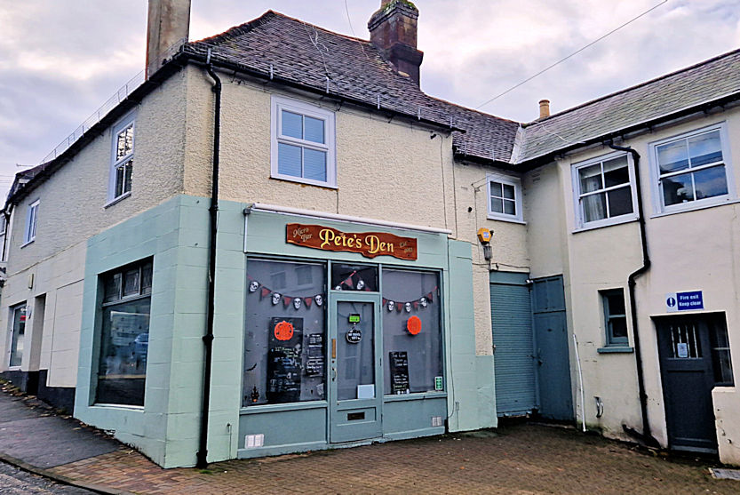
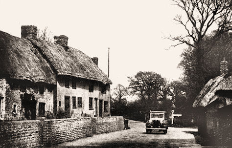
3. Stubbs Hill, High Street.
The right-hand side of the street has changed little in 100 years.
What is Woodies News (later The Resourceful Squirrel) was the Red Lion PH. The pub closed in about 1932.
The stores at Winchester House at the top of the hill were purchased by G W Stubbs, draper, in 1923 and
old Angmering families still refer to the hill as Stubbs' Hill.
What is Woodies News (later The Resourceful Squirrel) was the Red Lion PH. The pub closed in about 1932.
The stores at Winchester House at the top of the hill were purchased by G W Stubbs, draper, in 1923 and
old Angmering families still refer to the hill as Stubbs' Hill.
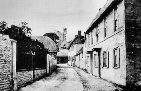
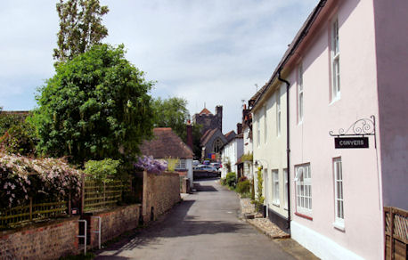
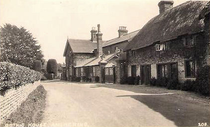
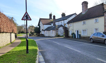
4. Church Road. One of the
prettiest roads in Angmering containing a number of Listed Buildings.
Conyers (on the right) may date from c1450 while St Nicholas House (next door) is said to date from 1585.
The road has also been known as Pook's Hill, Church Row, and Church Lane.
Note that Blaber Cottage further down on the left of the road was thatched 100 years' ago.
Conyers (on the right) may date from c1450 while St Nicholas House (next door) is said to date from 1585.
The road has also been known as Pook's Hill, Church Row, and Church Lane.
Note that Blaber Cottage further down on the left of the road was thatched 100 years' ago.
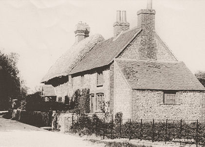
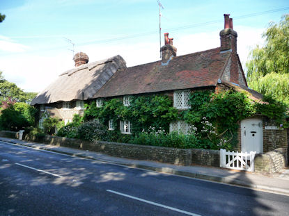
5. Station Road. Old Mill
House (left) and The Old Cottage (right).
These properties are probably more than 250 years old with Old Mill House probably being the slightly older of the two.
There has been little change in them in the last 100 years but a new entrance to The Old Cottage
has been made in the right-hand side "outshut", probably in the 1940s.
These properties are probably more than 250 years old with Old Mill House probably being the slightly older of the two.
There has been little change in them in the last 100 years but a new entrance to The Old Cottage
has been made in the right-hand side "outshut", probably in the 1940s.
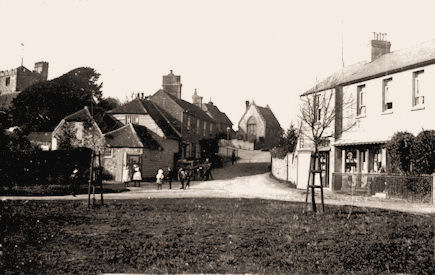
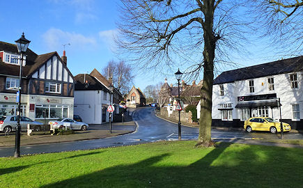
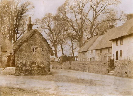
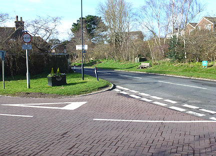
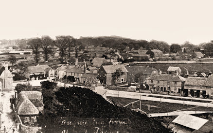
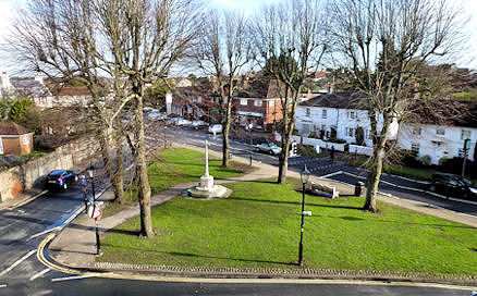
6. The Green & Church
Hill. Blaber House (on the right) is little changed but it
has gone from a
grocery store to an antiques shop to a dental surgery to private housing. Vestry Hall can be seen at the top of the hill.
All the buildings on the left-hand side of the hill were replaced in the late-1920s and early-1930s including a dairy on the extreme left.
The old photo was taken in about 1906/7, a couple of years after the lime trees were planted. The church tower can no longer
be seen from the Green, obliterated by the shops. Those shops interestingly stand on land once held by Poling parish.
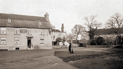
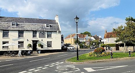
7. The Square. Photos taken at
the bottom of Stubb's Hill (High Street) looking across The Square.
On the left, almost touching The Lamb Inn, was the Terry family's castellated house blocking what is now The Lamb's
car park entrance. On the right were The Bunnes (17thC cottages), demolished c1937. The late18thC house, now Eachways,
(out of sight in the old photo) can be seen on the right in the modern photo - this was once the village police constable's residence.
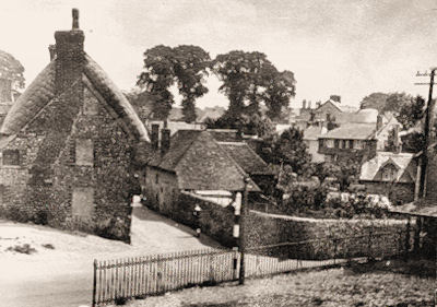
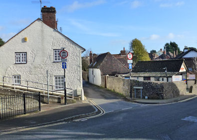
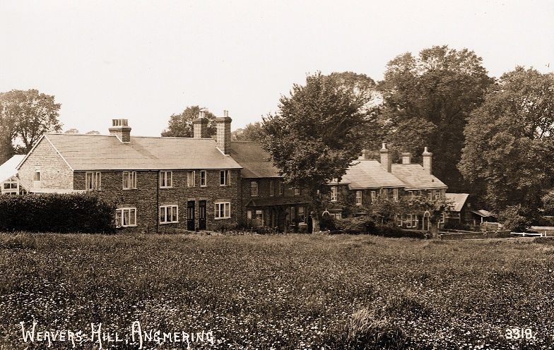
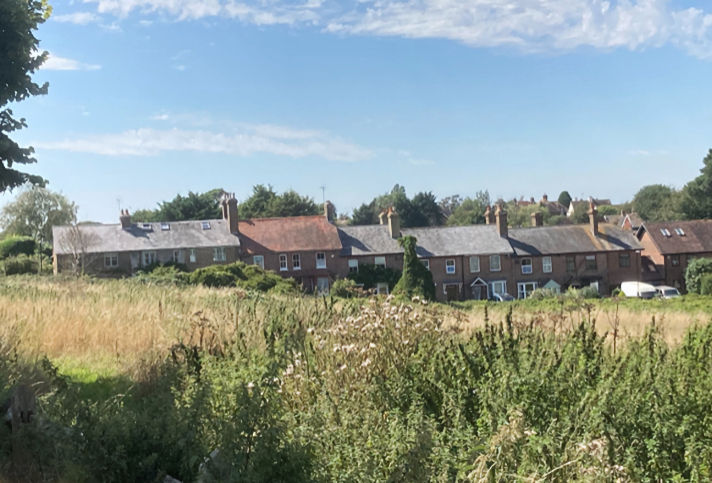
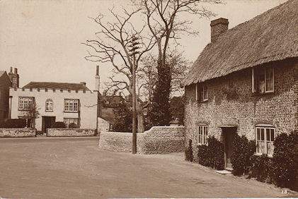
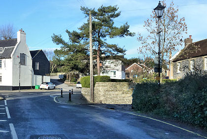
8. Water Lane junction with Weavers
Hill. What a change! The cottages on the left-hand side were
demolished in 1936. The small thatched cottage on the corner of Weavers Hill, adjacent to Weavers Cottage,
burned down in the early 1930s. During WW2, the bank on the left-hand side was mined to protect the village
in the event on an enemy invasion. The mines were removed in 1944.
demolished in 1936. The small thatched cottage on the corner of Weavers Hill, adjacent to Weavers Cottage,
burned down in the early 1930s. During WW2, the bank on the left-hand side was mined to protect the village
in the event on an enemy invasion. The mines were removed in 1944.
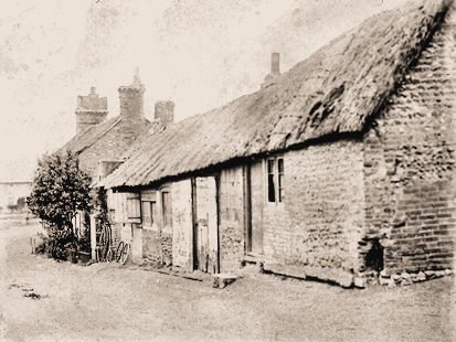
9. Water Lane. The cottages,
now painted white, on the left-hand side are Gladstone Cottages built by
the Angmering builder, historian and Socialist, Edwin Harris, in 1898. In the old photo, taken c1906, the open Black Ditch
or Patching Stream can just be seen. This was culverted in the early 1930s. The houses in the far distances are the ones
demolished in 1936 (see photo 8)
the Angmering builder, historian and Socialist, Edwin Harris, in 1898. In the old photo, taken c1906, the open Black Ditch
or Patching Stream can just be seen. This was culverted in the early 1930s. The houses in the far distances are the ones
demolished in 1936 (see photo 8)
10. Stubbs Hill (High Street).
The shop at the top of the hill was Winchester House (now Cottrell
House and
Winchester House). It's name derived from Richard Winchester who ran a draper's business there until 1903. The photo was taken
in about 1905 after it became Marsh's furniture store. In 1923, it was bought by George W Stubbs and returned to being a draper's shop.
Note that, further down the hill, the main part of Vine Cottage, with a Victorian entrance, was thatched 100 years ago.